

Introduction
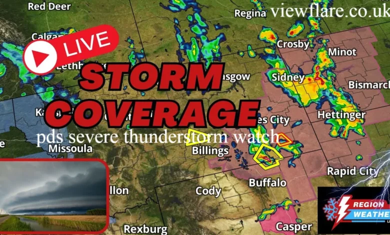
When your phone buzzes with a weather alert, most people glance at it and move on. But if that alert says PDS severe thunderstorm watch, you need to stop what you are doing right now. This is not your average storm warning. It is one of the most serious alerts the National Weather Service issues, and ignoring it can put your life in real danger. A PDS severe thunderstorm watch signals that conditions are ripe for an exceptionally dangerous and life threatening storm. These watches are rare and reserved for situations where meteorologists expect the worst possible outcomes. They anticipate violent tornadoes, destructive hail the size of baseballs, and straight line winds strong enough to level trees and power lines. In this article, you will learn exactly what PDS means, how dangerous these watches truly are, what separates a watch from a warning, and step by step actions you should take to keep yourself and your family safe. We will also explore the states most frequently hit by these events, including Texas, Oklahoma, Kansas, Nebraska, and Missouri.
What Does PDS Mean in a Severe Thunderstorm Watch?
PDS stands for Particularly Dangerous Situation. The National Weather Service adds this tag to a severe thunderstorm watch only when the threat level goes well beyond what a typical severe weather event looks like. Think of it as a red flag on top of an already red flag.
According to the Storm Prediction Center, a PDS severe thunderstorm watch is issued when the atmosphere is primed for an outbreak of violent, long tracked tornadoes or extreme thunderstorm activity covering a large geographic area. The storms expected during a PDS event can produce softball sized hail, tornadoes rated EF3 or higher, and wind gusts exceeding 80 miles per hour.
It is important to understand this is not about light rain or even a typical summer thunderstorm. The PDS tag means meteorologists have high confidence that the storms forming will be rare and potentially catastrophic. When you see those three letters, treat them as an urgent call to action. The acronym might seem simple, but it carries enormous weight in the weather world.
Is a PDS Severe Thunderstorm Watch Dangerous?
Yes, absolutely, and it deserves to be taken extremely seriously. A standard severe thunderstorm watch already covers significant threats. A PDS severe thunderstorm watch raises that danger to a whole new level. The storms associated with these events have been responsible for mass destruction across entire regions and multiple states.
Here is what makes these events so alarming:
- Hail can reach sizes of two inches or more in diameter, capable of destroying roofs, shattering windshields, and injuring people caught outside
- Wind gusts during PDS events frequently exceed 75 to 100 miles per hour, which is enough to toss vehicles and collapse structures
- Tornadoes are often embedded within PDS level storms and can form with little warning time
- Flash flooding can occur rapidly, especially when these storms slow down or stall over an area
- Power outages are common, leaving communities without communication or emergency services for hours or days
If you live in or near the watch area, do not go outside to watch the storm. Do not assume you are safe just because the sky looks clear at the moment. Conditions can change in minutes, and these storms move incredibly fast. Taking these watches lightly is a mistake that can have serious consequences.
What Is the Difference Between a PDS Watch and a Warning?
This is one of the most common questions people ask, and it is an important one to get right. A watch and a warning are very different alerts, even though they sound similar.
Severe Thunderstorm Watch (Including PDS)
A watch means conditions are favorable for severe thunderstorms to develop over a broad area. It is issued hours in advance. The storm has not happened yet, but the ingredients are there. Think of it as a heads up to stay alert and prepare. The watch covers a large region, sometimes spanning multiple states or counties.
During a watch period, you should monitor weather carefully and be ready to act. Your job is to get prepared before the storm arrives. Charge your devices. Know where your shelter location is. Keep emergency supplies accessible. The watch is your warning system telling you that danger is possible.
Severe Thunderstorm Warning
A warning means a severe thunderstorm has been spotted or confirmed by radar. It is happening right now or is about to hit your specific location. When a warning is issued, you have very little time to act. You need to take shelter immediately. A warning is much more localized than a watch and covers a smaller area.
When a warning sounds, do not delay. Do not finish what you are doing. Do not check your email. Move to your shelter location now. This is your last chance to get to safety before the storm arrives.
A PDS watch is the step before the warning. Use that watch time wisely. By the time the warning sounds, you want to already be prepared and ready to move quickly.
What Should You Do During a PDS Severe Thunderstorm Watch?
Acting early is the single most important thing you can do during a PDS severe thunderstorm watch. Here is a practical, step by step approach to keep yourself safe:
- Monitor weather updates constantly using a trusted weather app, local news, or a NOAA weather radio. Do not rely on a single source. Check updates every 15 to 30 minutes.
- Identify your safe shelter now. Go to the lowest level of a sturdy building. Stay away from windows. An interior room or bathroom on the ground floor is ideal. Never use a mobile home for shelter during severe weather.
- Charge your phone and backup batteries immediately. Power outages are common during severe storms. You want to stay connected and informed.
- Secure outdoor items like patio furniture, grills, trash cans, and anything the wind could pick up and turn into a dangerous projectile. Bring pets inside to a safe room.
- Do not drive into storms. Many storm related deaths happen in vehicles. If you are on the road, get to a solid structure immediately. Never try to outrun a storm.
- Have a family plan in place. Know where everyone will go and have contact information ready. Make sure children understand what to do.
- Gather emergency supplies including water, first aid kit, flashlight, and battery powered radio. Keep these items in your shelter location.
One tip I always share with friends is this: do not wait until you hear thunder to act. By then, the storm is already close. Use the watch time to get ahead of it and position yourself safely.
How Long Does a PDS Severe Thunderstorm Watch Last?
Most severe thunderstorm watches, including PDS watches, last between four and eight hours. The Storm Prediction Center typically issues them in the morning or early afternoon when meteorologists can clearly see the atmospheric setup for that day. They provide enough time to prepare but make it clear that danger is coming soon. source: Iowa Environmental Mesonet
The watch can be cancelled early if the threat diminishes or if storms fail to develop as expected. It can also be extended or upgraded if conditions worsen. Do not assume the watch is over until you receive official confirmation from the National Weather Service. Stay connected to alerts throughout the entire watch period.
Some PDS watches last the entire day if the atmospheric setup remains favorable for multiple rounds of storms. Keep checking your weather apps and local news stations for updates about when the watch expires.
PDS Severe Thunderstorm Watch in Texas
Texas experiences some of the most severe weather in the entire United States. The panhandle region in particular sees frequent PDS level events during spring. Warm, moist air from the Gulf of Mexico collides with dry air from the west, creating the perfect recipe for violent storms. Large hail and tornadoes are common in this region.
Residents in north and west Texas need to stay especially vigilant from March through June. This is prime severe weather season in the state. The Lubbock and Amarillo areas have experienced some of the largest hail events on record. If you live in these regions, having a solid emergency plan is not optional, it is essential.
PDS Severe Thunderstorm Watch in Oklahoma
Oklahoma sits at the heart of Tornado Alley and is no stranger to PDS watches. Some of the most destructive tornadoes in recorded history have touched down in Oklahoma, and the same atmospheric dynamics that produce those tornadoes also drive extreme thunderstorm events. Cities like Oklahoma City and Tulsa have experienced multiple PDS level events in single storm seasons.
The state’s geography and climate make it particularly vulnerable. Oklahoma residents grow up understanding severe weather, and most keep emergency plans ready during spring. If you move to Oklahoma, learning about storm safety should be one of your first priorities.
PDS Severe Thunderstorm Watch in Kansas
Kansas is synonymous with severe weather nationwide. The flat terrain offers nothing to slow down a supercell thunderstorm. PDS watches here often cover the southern and central portions of the state. Hail events in Kansas have caused billions of dollars in agricultural and property damage over the decades.
Wind events frequently knock out power to thousands of homes. Residents in Kansas are particularly well educated about severe weather because they experience it so regularly. The state has some of the best storm spotters and weather aware communities in the nation.
PDS Severe Thunderstorm Watch in Nebraska
Nebraska might not get as much media attention as Texas or Oklahoma, but it is one of the most hail prone states in the country. PDS severe thunderstorm watches roll through Nebraska regularly between May and July. The southern Nebraska plains are particularly vulnerable to these extreme events.
Storm chasers often converge on Nebraska during this season because the storms here are so reliably intense and visually dramatic. The state’s agricultural economy has been heavily impacted by hail damage from severe storms over many years.
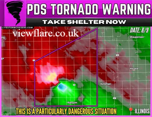
PDS Severe Thunderstorm Watch in Missouri
Missouri sits at the crossroads of several major storm corridors, making it a frequent target for PDS watches. The state has experienced devastating tornado and storm outbreaks that caused widespread destruction. Spring and early summer are the most dangerous months for severe weather in Missouri.
Residents in the southern and central parts of the state need to pay close attention to watches issued by the Springfield and St. Louis National Weather Service offices. Major cities like Kansas City and St. Louis are not immune to these severe events.
Conclusion
A PDS severe thunderstorm watch is not something to scroll past on your phone or dismiss as regular weather news. It is a serious, carefully considered alert that means the atmosphere is set up for dangerous and potentially deadly weather. When you see those three letters PDS, they mean conditions are particularly dangerous and the threat is very real.
Whether you are in Texas, Oklahoma, Kansas, Nebraska, or Missouri, or anywhere else that falls within a watch box, your response to a PDS watch can make a real difference in your safety. Monitor alerts consistently. Prepare your shelter ahead of time. Stay off the roads when dangerous weather approaches. And most importantly, do not wait until the last moment to take action.
Have you ever experienced a PDS severe thunderstorm watch in your area? Share this article with someone who lives in a storm prone region. It could be the information they need when it counts most.
Frequently Asked Questions
1. What does PDS stand for in weather?
PDS stands for Particularly Dangerous Situation. It is a designation added to weather watches when conditions are expected to be significantly more severe and threatening than average.
2. How rare is a PDS severe thunderstorm watch?
PDS watches are relatively uncommon. They are issued only when meteorologists have high confidence that a storm outbreak will be exceptionally dangerous. You might see a handful of them across the country each year.
3. Can a PDS watch become a tornado warning?
Yes. A PDS watch sets the stage. As storms develop, individual tornado or severe thunderstorm warnings can be issued for specific areas within that watch zone.
4. Should I evacuate during a PDS severe thunderstorm watch?
Evacuation is not typically necessary for a thunderstorm watch. Sheltering in place in a sturdy building is usually the safest option. Avoid being on the road when storms are approaching.
5. What is the safest place to be during a PDS severe thunderstorm?
The safest place is an interior room on the lowest floor of a sturdy building, away from windows. A bathroom, closet, or hallway in the center of the structure works well.
6. Who issues a PDS severe thunderstorm watch?
The Storm Prediction Center, which is part of the National Weather Service, issues all severe thunderstorm and tornado watches, including PDS watches.
7. Is a PDS watch worse than a regular severe thunderstorm watch?
Yes. A PDS watch signals a significantly higher threat level. It means meteorologists expect more violent, widespread, and longer lasting storm activity than a standard severe thunderstorm watch covers.
8. Does a PDS watch always lead to significant damage?
Not always. The watch means conditions are favorable for dangerous storms, but outcomes can vary. You should always take them seriously regardless.
9. Can I track a PDS watch in real time?
Yes. Weather apps show active watches and warnings in real time. NOAA Weather Radio broadcasts continuous updates and is especially useful when power and cell service are unreliable.
10. How is a PDS watch different from a PDS tornado watch?
A PDS severe thunderstorm watch focuses on extreme thunderstorm threats like giant hail and catastrophic wind. A PDS tornado watch signals that violent, long track tornadoes are the primary concern. Both are serious, but they highlight different threats.
About the Author : Jordan Hayes is a weather safety writer and outdoor preparedness advocate with over a decade of experience covering severe weather events across the Great Plains and Midwest. Having grown up in Oklahoma, Jordan developed a deep respect for the power of severe thunderstorms from an early age. Jordan writes to help everyday people understand complex weather alerts and take smart, fast action when dangerous conditions threaten their communities. When not writing, Jordan can be found monitoring storm systems and helping friends prepare their emergency plans before severe weather season arrives.
email: johanharwen@314gmail.com
Author Name: Jordan Hayes